
Unique Solutions
Learn how FlowWest provides answers to our clients’ greatest problems.
FlowWest applies creative, science-based solutions to a wide array of challenges. Read about some of our most recent successes below - from emergency river engineering to planning for the future of California’s water sustainability.
Geomorphically-informed design at high speed

unexpected challenges
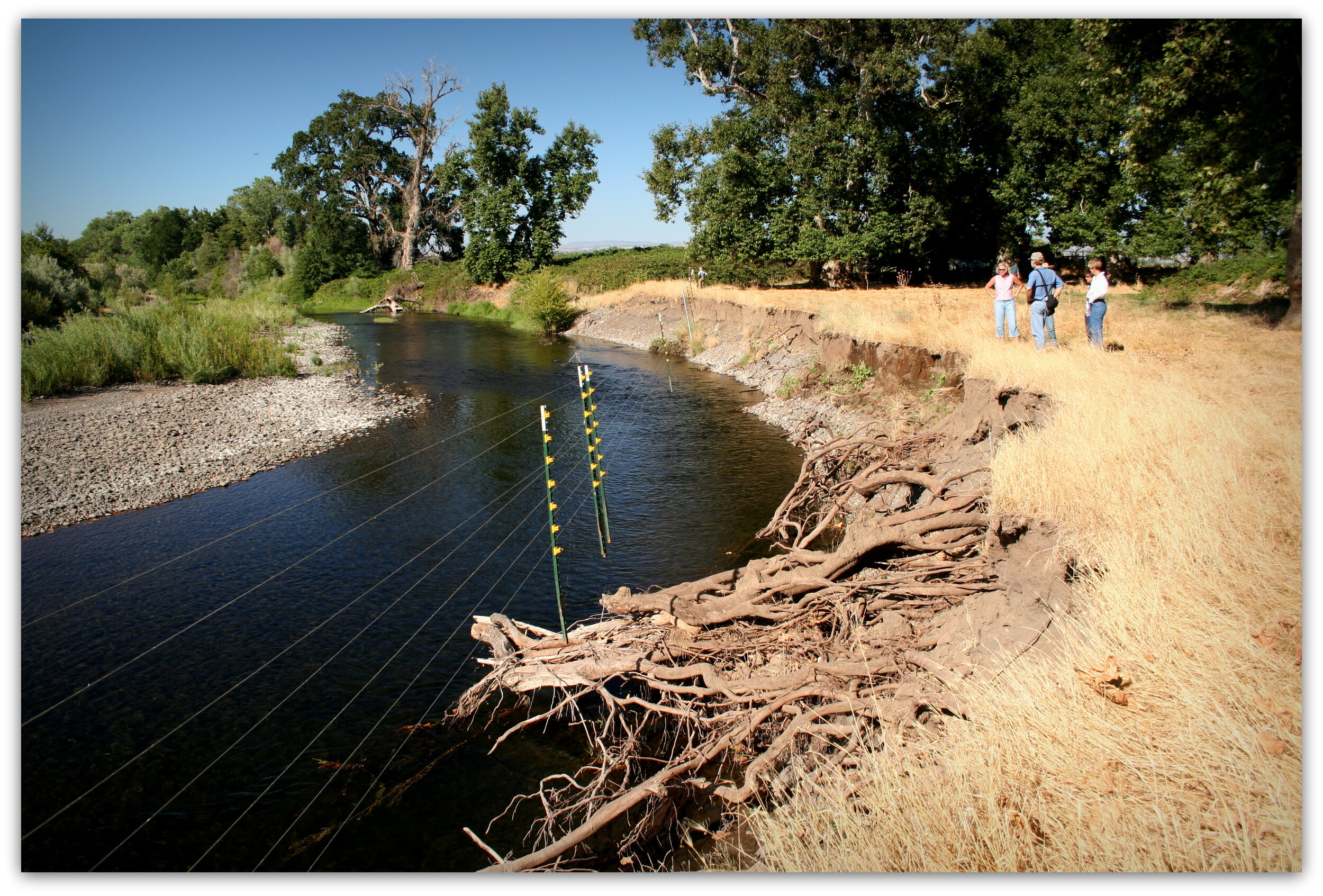
In early 2017, the Zone 7 Water Agency called FlowWest with a big problem. Heavy rains and flows in the Livermore Valley had blown out a stream bank on Arroyo De La Laguna on the outskirts of Pleasanton - a 40-foot high bank had retreated at least 40 feet and threatened homes.

Approaches that Deliver
We led a team that achieved what initially seemed impossible. Between March and October 2017 we designed, permitted, and constructed a ~$3.5 million project that stabilized the stream bank using virtually all natural materials, created new riparian habitats; and addressed geomorphic problems in the reach to ensure that the project would be sustainable in the long term. The cost of failure would have been high.

ecological Alternative
Conventional engineers would have stabilized this bank with inert materials that deteriorate with age. Our approach is ecologically based - it will get stronger as willows and other vegetation mature and it uplifts native habitats in the arroyo.
This rapid outcome required creativity, ability to interact with and manage expectations and emotions of landowners and stakeholders, credibility with regulators, and knowing how to work hand-in-hand with the contractor to get the project built quickly and properly.
Restoring ecology and protecting community
Watershed in the Balance
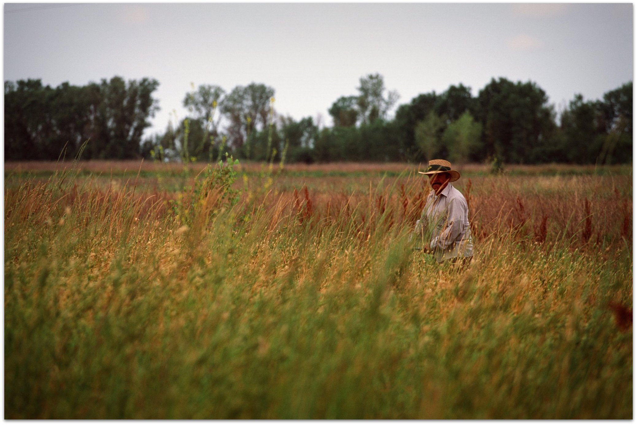
Deer Creek is one of only three streams in the Central Valley that still supports a viable wild population of spring-run Chinook salmon. The Creek has also been home to a thriving agricultural and ranching community for decades. Over time, flood protection infrastructure for the community and habitat conditions for salmon have degraded. The challenge of balancing the needs of both the salmon and the local community have made it hard to identify and fund a solution.

Flood Protection meets Salmon Habitat
FlowWest is addressing both concerns with the Lower Deer Creek Flood and Ecosystem Improvement Project. The solution includes raising and setting back levees to reduce flooding and provide more and better connected floodplain habitat, bank stabilization, flood easements, as well as bridge and diversion structure improvements. Together, these elements will provide the local community with the flood protection they need while increasing the amount and quality of salmon habitat - a win-win!

Open Data = Transparent Communication
Our team has been regularly meeting with community members in the Deer Creek watershed, resource agencies, and state government to identify solutions and build consensus for the project. To make more information available and accessible to all parties, we have created web-based data portals and tools to openly communicate project elements, hydraulic modeling output, and other important information about the project and its anticipated benefits.
Completion of this project relies on our skills in working collaboratively with stakeholders to
navigate complex natural resource management challenges.
Click here to view FlowWest’s data visualization and planning app.

Real-Time Water and Fisheries Coordination
Upper Sacramento River Valley, CA
Data-driven insights aid salmon recovery

smarter decision making
Managing outflows from Shasta Dam to protect the endangered Winter Run Chinook Salmon is tricky business. Every release must balance flow rate, temperature, and fish locations to keep conditions optimal. FlowWest’s Shasta Operations for Winter Run (SHOWR) web application dashboard provides quick insights on all of these important parameters to drive release decisions. The dashboard page was designed collaboratively with water managers and fisheries experts to give users a simplified yet informative view of the system.

power to stakeholders
For stakeholders who want to drill into the details, the Temperature and Flow pages on SHOWR showcase analytics, visualizations, and context for both new and expert users engaged in flow management for Winter Run. Temperature is the most critical component of Winter Run management and SHOWR makes comparisons to standards and conditions in previous years extremely easy.

Precision Management
The numbers and locations of Winter Run in the system drive management needs. The Winter Run page of SHOWR grew out of our work with the California Department of Fish and Wildlife (CDFW) and provides near real-time access to the latest Winter Run aerial survey data. Users can view current and historical counts, as well as spawning locations at the reach level. We also collaborated with salmon life history experts to build in functionality that forecasts expected emergence data for baby Winter Run incubating in their gravel nests, allowing users to forecast operations and determine the need for temperature management flow releases.

Sustainable Groundwater Management Support
Solano County, CA
Smart Balancing of Agricultural and Ecosystem Values
Guiding sustainable groundwater management
Solano is home to both valuable agriculture as well as vibrant Delta ecosystems. FlowWest helped Solano County and local water resources managers comply with the Sustainable Groundwater Management Act. Groundwater extraction is not uniformly monitored in the County, challenging long-term sustainability planning. Our team solved this problem by developing tools to organize, create, and synthesize available data in new ways. This gave managers a better water resources understanding and a foundation for planning.

Powerful tools maximize use of critical information
We conducted consumptive use modeling of water demand throughout the County based on crop type, compared water demands and deliveries, and developed maps of historical groundwater level trends. Our team also developed a data library for the County that includes measured and modeled groundwater and surface water data that will serve as a framework for future data acquisition and support future modeling efforts. We then developed a cutting-edge, customized web application to effectively communicate the data for the benefit of decision making.

Success With data-driven, Personal collaboration
Collaboration is one of FlowWest’s core values - and this project put our collaborative capabilities to the test. Successfully acquiring existing data that were spread across multiple agencies and organizations and making sure to capture institutional knowledge not always captured in the data itself challenged us. We succeeded with a personal approach - working face-to-face with growers, water managers, and decision makers as we developed our models and web application to ensure we provided stakeholders with tools to quickly understand data sources and to influence data usage.

Dennett Dam Removal
Tuolumne River Trust - Modesto, CA
Making the Tuolumne safer for fish and people
Long-Term Committment
Originally built in 1935 to create a swimming hole, Dennett Dam blew out and was rebuilt twice. The third time it washed away, all that was left was a jagged, steel sheet pile wall that blocked fish passage and prevented safe boating. FlowWest worked tirelessly for over a decade with the Tuolumne River Trust raising funds, planning, designing, and ultimately monitoring demolition of Dennett Dam. Even though the dam posed serious risks to public safety and blocked migration of salmon on the Tuolumne, it took perseverance and creative technical approaches to make dam removal a reality.

A challenging multi-benefit project
Removing Dennett dam required temporary rerouting of the entire Tuolumne River during a 12-week construction window. FlowWest worked with the City of Modesto and State and Federal regulatory agencies to deliver a safe dam removal design and a pro-active environmental compliance approach to make the job a success. Leveraging our deep experience implementing river construction projects, we helped Modesto weather multiple surprises leading up to and during the removal. With our help, the dam was removed and the river restored.

Rebuilding a community
This wasn’t just a job to the FlowWest family. The Tuolumne River is a special place, and FlowWest was and remains committed to the improvement of this river for the people and creatures that live around and in it. The whole FlowWest team couldn’t have been prouder on ribbon cutting day after the dam was gone!

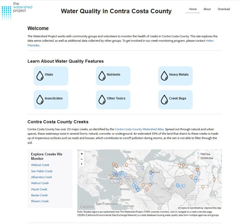
Citizen Science Water Quality Web Application
The Watershed Project - Contra Costa County
Data Visualization Empowering Local Communities

Community-Led Water Quality Monitoring
FlowWest partnered with The Watershed Project (TWP) to develop a tool that helps local communities store, manage, and understand the data they collect in their local watershed. TWP supports grassroots watershed organizations and nurtures young people to aspire to environmental careers by engaging with students, teachers and volunteers directly in creek beds and on the shorelines. Based out of Richmond, CA since 1997, TWP is committed to building resiliency, community, and awareness in the Bay Area by bringing a watershed perspective to the urban environment.
Engaging Our Neighbors
The Citizen Science Water Quality Web Application (the app, https://app.thewatershedproject.org/) explains basic water quality concepts and provides a watershed scorecard so community members can quickly and easily assess their watershed’s water quality health. Users of the app can explore the water quality sampling sites within their watershed through interactive plots that illustrate each parameter and the safe thresholds. Armed with local water quality data, community organizers and watershed stewards can work with city, county, state, and federal agencies to implement restoration and urban greening projects to improve water quality conditions in their watersheds.

Easy to use
Although only recently developed, the app has already been used to showcase results from watershed education programs run by TWP for students in elementary (Kids in Creeks - Grades 2-4) and middle/high school (From Me to the Sea - Grades 6-12). Data collected by student citizen scientists is uploaded to the app and allows students to draw connections between the data they collected and previous data collected by other student scientists.


